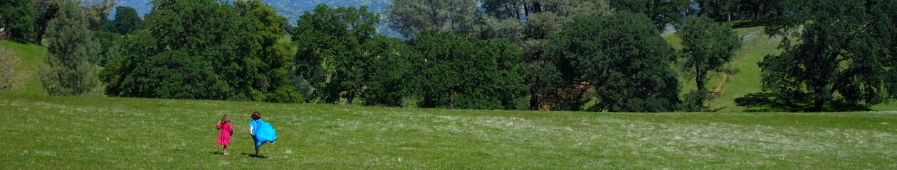
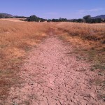
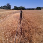
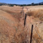
Across the northeast corner of the property is a ditch, which we are told is the remnants of something known as the Rumsey Ditch. From what I can gather, the Rumsey Ditch was an irrigation ditch used to help irrigate the west side of the valley. It took water from the Cache Creek to feed the farmland. Other than that, I haven’t been able to find much information about the Ditch – when it was constructed, when it was abandoned, etc. You can trace most of its path along the landscape even in current aerial photographs. And, as best as I can tell, it crosses back across the southeast corner of the property as well. It is also interesting to note that the ditch held water – most likely surface runoff from the hills – up through at least April.
Online searches have revealed to me the following tidbits:
– the Rumsey Ditch is/was 8 miles long
– may or may not have been connected to, or also referred to as the “Guinda Ditch”
– may or may not have been operated by the Capay Valley Ditch Company
Here’s some of the more interesting results of my internet search:
Rumsey & Guinda Ditches:
– in the 1960’s & 1970’s there are references to these ditches in State Water Resources Control Board Decisions (such as here and here)
– The Rumsey Hall history page references use by the Rumsey Ditch Association (is this current? or past?)
– the Capay Valley Watershed Stewardship Plan references the Rumsey Ditch Association’s eight mile irrigation canal (p. 23)
Capay Valley Ditch Company:
– Google books has a lovely 1921 Highway Magazine article about the construction of what they call the Capay Valley Ditch, by the Capay Valley Ditch Company of Guinda. Is this the same ditch?
– The California Digital Newspaper Collection has a brief mention of the Capay Valley Ditch Company in a 1920 edition of the Pacific Rural Press. It notes that the Company was suing for access to former “Spring Valley Water Company” ditch water from the Yolo Water & Power Company.
– Also on Google Books is a digitized version of Electrical West from 1920, referencing the forming of the Capay Valley Ditch Company as a new irrigation district.
Other:
– This 1879 Atlas of Yolo County shows the ditch labeled “Capay Ditch”
– This 1871 Map of Yolo County shows the ditch labeled “Capay Valley Water Ditch”. It also shows the ditch traveling southeast all the way to the mouth of the Valley (and it’s fun to check out the “High Precipitous Hills”, note that everything west of the valley floor was simply “Dividing Ridge”, etc.)
– There’s an interesting history of Yolo County’s rights to Lake County’s water here.
– Three USDA publications from the early 1900’s reference the Rumsey Ditch (aka East Fork, Lateral of Moore Ditch), but it’s not clear if this is the same ditch.
— This 1909 publication by the USDA examines the state of the entire system of Sacramento Valley irrigation canals;
— This 1914 Bulletin discusses benefits of lining canals with concrete;
— This 1901 publication describes a ditch built from Rumsey to Guinda (p178). It also has a fascinating description of the wheat and barley growing practices at the time (p 163); a discussion of the water appropriation laws of California (p 164); and a summary of lawsuits regarding use of water from the Cache Creek.